• Contestants must be at least 18 years of age and must reside within the state of California. • Limited to one entry per person. Multiple entries and incomplete entries will be disqualified. • Employees of Northern California Public Media are not eligible to win. • Contestants may need to claim prizes within a certain time frame. • Contestants may need to provide identifying information to claim prizes. • Contestants may need to accept prizes as is or forfeit them.
Conditions:
By entering, entrants agree to these official rules; all decisions by NorCal Public Media shall be final. Noncompliance with the official rules will result in disqualification. Prizes are not redeemable for cash and are not transferrable. All costs and expenses not specifically listed in the prize description are the responsibility of the winner, including all federal, state and local taxes which apply. In the event the prize becomes unavailable, NorCal Public Media reserves the right to substitute a prize of comparable or greater value. Odds of winning depend on the number of eligible entries received. NorCal Public Media and its contest sponsors are not responsible for error, omission, interruption, deletion, defect, delay in operations or transmission, theft, destruction, unauthorized access to or alterations of entry materials, or for technical, network, telephone, computer, hardware or software malfunctions or malfunctions of broadcast transmission or reception. NorCal Public Media and its sponsors are not responsible for inaccurate transmission of, or failure to receive entry information for any reason. NorCal Public Media and its sponsors are not responsible for any injury or damage to any computer related to or resulting from displaying entry materials or from entering any contests. NorCal Public Media reserves the right to cancel any contest in its entirety, at its sole discretion, for any reason. All entries become the property of NorCal Public Media and will not be acknowledged or returned. By entering, entrants agree to release NorCal Public Media its sponsors, divisions, subsidiaries, affiliates, officers and employees from any and all liability for any injury, loss or damage of any kind caused by participation or resulting from acceptance, possession, use or misuse of any prize, and acknowledge that said parties have not made any warranty, representation or guarantee, expressed or implied, in fact or in law, relative to the prize, including, but not limited to, its quality. By entering you also agree to receive future marketing email correspondence from NorCal Public Media.
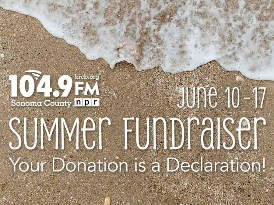
You believe in news, information, and entertainment from a trusted, independent, and essential source – Northern California Public Media.
When you donate to NorCal, you help support these essential services for you and your community.
Whether you make a one-time gift or become an ongoing sustaining contributor, if you opt to receive a thank you gift, you can still receive a tax deduction for the amount of your donation minus the value of the gift.
Thank you for your support!
Other Ways to Support Northern California Public Media
NorCal Welcomes Gifts of Stock or Other Appreciated Securities
To Give Stocks& Other Appreciated Securities, please give your broker the following information:
Deliver to: Charles Schwab DTC# 0164 Code 40 Account Number: 7703-0117 Account Name: Rural California Broadcasting Corporation Federal Tax ID (501c3): 94-2718837
Questions? Contact Our Membership Team DONATION PHONE ASSISTANCE: Alex or James at 707-584-2018 EMAIL:This email address is being protected from spambots. You need JavaScript enabled to view it.
About NorCal Public Media
LEGAL NAME:Rural California Broadcasting Corporation (dba Northern California Public Media) FEDERAL TAX ID:94-2718837 MAILING ADDRESS:5850 LABATH AVE, ROHNERT PARK, CA 94928
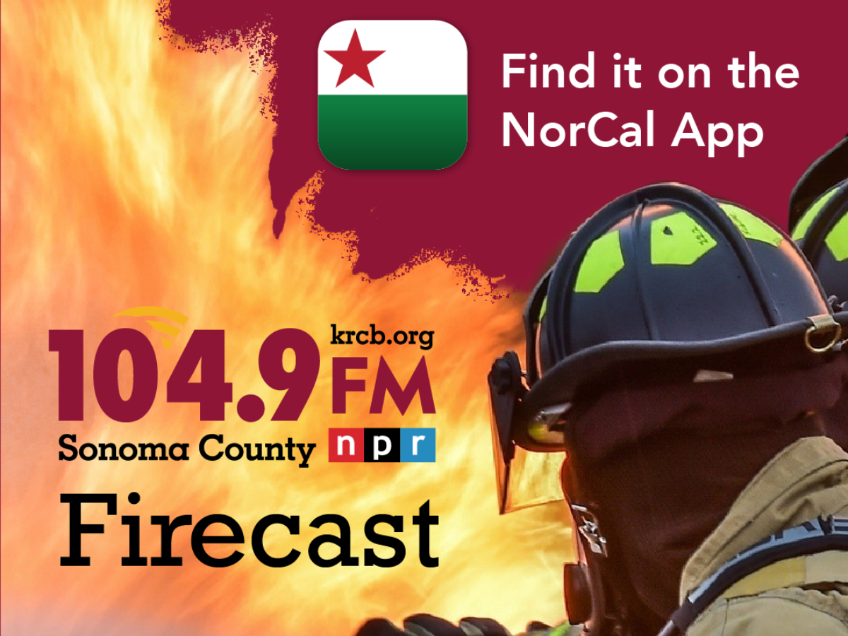
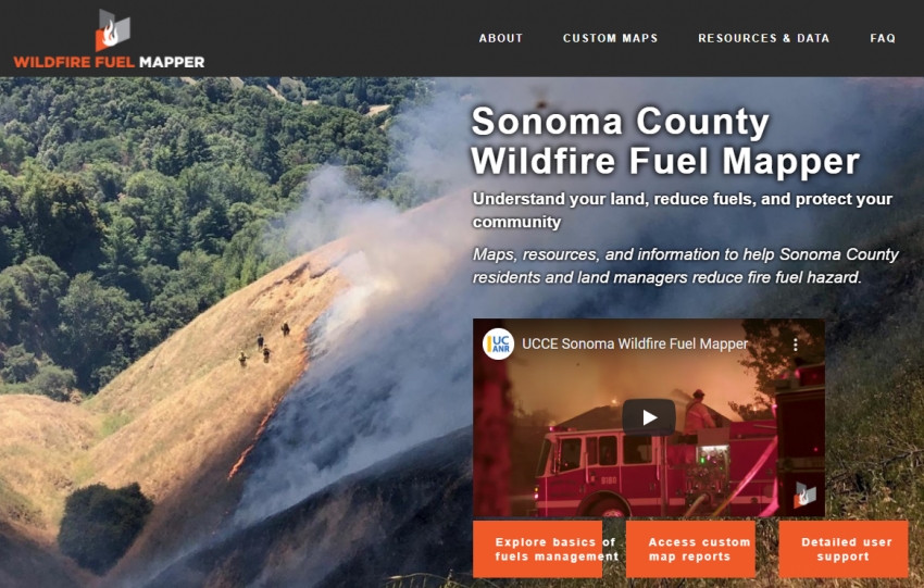
Stay updated with real-time fire, wind and smoke maps. Access crucial evacuation information to ensure your safety. Monitor live cameras for on-the-ground visuals to stay ahead of the situation. With Firecast, you have everything you need to stay informed during wildfire season.
The county of Sonoma lists the current evacuation orders and evacuation warnings here. You can zoom in to see more detail.
Wind
Wind, particularly at higher elevations, can be a powerful force in fire growth. Here are the current wind conditions and forecast. (Scroll right for subsequent days.)
You can check live cameras on many North Bay mountaintops to look for fires. Click https://alertcalifornia.org/ to go to that site.
Sometimes the evacuation map will lag by a few minutes. County of Sonoma emergency announcements may show up on their social media first, check their X (twitter) account for updated information.
911 fire calls could indicate a problem before satellites can see it. Below are the active fire and medical 911 calls in Sonoma County. Note you can also see these calls displayed in "map view."
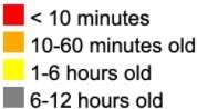
Above is a fresh image from the fastest but least accurate satellite heat detection system, called GOES-17. Compare the timestamp on the map to the current time: this image should be less than six minutes old. You can reposition the map and zoom in and out. Hot spots are detected where you see colored rectangles. Each rectangle is roughly 2 Km x 2 Km (1.25 x 1.25 mi). This does not reliably show you boundaries for a given fire, but it tells you there's probably fire or smoke somewhere inside that area. The color of the rectangle indicates how old the report is:
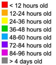
MODIS and VIIRS are different satellites that are more accurate, with a visual resolution of .6 miles and .22 miles, respectively. Inside that range, they cannot further differentiate where heat/smoke are. These satellites only pass overhead once or twice per day.
Hot spots appear as asterisks. Here again, colors indicate the age of the hot spot report:
You can zoom in to see more information like the time of the flyover and the measured ground temperature associated with each hotspot.
Click here to see known fire starts, as identified by GIS professionals from emergency agencies and social media.
NWS Advisories
The National Weather Service is responsible for issuing Red Flag fire warnings or fire weather watches. Any current watches or warnings will be listed here:
KRCB 104.9 FM Sonoma County's NPR Station
KRCB 104.9, our Public Radio Station We report on all major local emergencies. Listen on your radio dial 104.9 FM or online at krcb.org (and hyper link krcb.org).
We've done our best to curate the most useful online tools for identifying fires and staying abreast of their progress. If you discover new ones you'd like us to include, please contact us at This email address is being protected from spambots. You need JavaScript enabled to view it.. KRCB 104.9 features NPR + Sonoma County news during morning and evening commute time, with local DJs playing music and talking about community events most of the rest of the time. We'll break in with news as needed. Tune in! (and thanks). Please visit www.krcb.org/join to learn more or help support Sonoma County's public radio station.
NorCal Public Media’s Original series “Prepare Yourself!” takes a unique approach to disaster preparation, with clever satire, entertaining skits, and original music. Our hosts guide you through memorable moments that have fun, yet relay important information about home emergency kits, go-bag readiness, property protection, and how neighbors and communities can help each other during emergencies and evacuations.
Fantastic Negrito joins Doug Jayne on KRCB 104.9 FM. Fantastic just finished a European Tour (he was in Germany on the recording) and will be coming to Napa on September 13, as part of the Blue Note Summer Sessions. Have a listen!
Emma Swift is a native of Australia but has lived in Nashville since 2013. We were thrilled that before her music career she was a radio host. In 2020 Emma released a brilliant album of Bob Dylan covers Blonde on the Tracks. She has recorded and toured extensively with her partner Robyn Hitchcock. Emma brought in some…
Greg Loiacono is known as a co-founder of the popular band the Mother Hips, formed with partner Tim Bluhm when they were students at Chico State. He has also had a great solo career, putting out several albums under his name. Now a new project -Stingray is in the works. Featuring some of the Bay Area's top talent,…
This week's episode with Michael Field showcases our local TV production, Climate California. Director Charles Loi, and co-producers Jeremy Jue, Hannah Lee, and Miguel Brierley talk about their Emmy Award-winning series.
Joelton Mayfield grew up in Texas, singing and playing in church. He was disillusioned by folks not practicing what they learned on Sunday during the week and began writing songs. Moving to Nashville ten years ago for college, he first studied the business of music, but switched majors to English. Joelton also studied…
Terrier is a pandemic era project by Ben Morrison (Brothers Comatose) and Erika Tietjen (T Sisters, Moonalice), The married couple started live streaming from home while lock down prevailed and found it so rewarding they decided to form the group. Both have busy schedules with their own bands, plus Ben & Erika have…
Doug chats with journalist, critic, and biographer Peter Ames Carlin. His latest book, TONIGHT IN JUNGLELAND - THE MAKING OF BORN TO RUN is available now. Have a listen!
Sean Hayes spent decades in San Francisco before his family moved to Petaluma. Originally from North Carolina, his delivery evokes warm summer nights, fireflies and sippin' whiskey. Fresh off a welcoming performance at the Rivertown Revival, he is headlining this weekend's Gravenstein Apple Fair. Sean speaks with…
Amy Berg is the Director of a new documentary about Jeff Buckley, It's Never Over: Jeff Buckley, coming August 8th to the Rialto Cinemas in Sebastopol. Have a listen!
Fede Petro is a singer-songwriter born and raised in Buenos Aires, Argentina (a city Brian has visited and loves). Now based in Los Angeles, the name of his current project is "Midnight Gaucho". Fede chats about his roots, busking in San Francisco, and how it's tough to be a vegetarian in a country known for its…
Judi Jaeger and Bob Reid perform and record as Jaeger & Reid. They came to Studio A to play some songs and have a conversation with Doug. Have a listen!
Doug Jayne speaks with Director Elliot Kirschner and Executive Producer Heather Kinlaw Lofthouse about their new film, The Last Class. The film follows the final semester of Robert Reich's 40 + years as a teacher. Have a listen!
Dave Alvin is no stranger to NorCal and he's back with three shows this summer. Growing up in Downey in Southern California, he learned his craft by seeing all the blues greats. He and brother Phil formed the Blasters in the seventies, and he's had many bands since including the Guilty Ones, Dave and Jimmie Dale…
Jim Wilder is founder of Sunflowers Across America. It's a grassroots effort to spread flowers as a symbol of hope and resistance, across our divided nation, starting with Sonoma County.
Chuck Prophet is a good friend to the station. He's helping out with our Summer Fundraiser by donating a pair of tickets to the 3rd annual Summertime Thing music festival 6/28 at the Rio Nido Roadhouse. Listen to his chat with Brian about the festival, upcoming tour plans and more.
The High Sonomen are a busy bunch of guys! Paul Riley, Dave Hooper, Dave Hamilton, and Randy Burrows joined Doug for some live music and conversation. Have a listen!
Stella Heath has been a good friend to the station for many years. She began singing gypsy jazz (in French)! She then branched out with classic standards. Heath developed a presentation on the life and music of Billie Holiday, and has since performed shows featuring tunes from Nat King Cole and Ella Fitzgerald.…
Taylor Rae is a NorCal girl. Growing up in the Santa Cruz mountains, she discovered her fondness for all kinds of music, from folk and jazz to psychedelic. These influences were heard on her debut album Mad Twenties. She visited Brian in Studio A to promote that record, and now she's back with a new release The Void.…
Tamara Klamner joined Doug for some music and conversation. They spoke about her upcoming performance at the Sonoma Wild Music Festival at SOMO Village Event Center on June 7th. Have a listen!
Singer-songwriters John Courage and Jacob (from Jacob) join The Lost Church's Bryce Dow-Williamson and Doug on Midday Music. Lots of new stuff to talk about. Have a listen!
Noah Dorrance of Bloodroot Wines is hosting The Ramble featuring Ziggy Marley and others. He joined Brian for a chat about the June 7th event. Have a listen!
Gillian Eichenberger is an actor, a teacher, and lead singer in the Taylor Swift Tribute band, "Swifty." She recently spoke with Doug on Midday Music. Have a listen!
Jeff Plankenhorn is a welcome visitor to Studio A. He just made another appearance on the Morning Music show with Brian. As J Plank, the guitarist and songwriter has put together a new album, The Bend, set for release in July. He shared several tunes with us as he makes his way down the coast including a stop at the…
Preacher Boy is the nom de plume of Christopher Watkins. He's been making records under this name for thirty years. His latest Ghost Notes has just been released. He spent time with Brian in Studio A playing some tunes and talking about higher education. He has a MFA in poetry. Preacher Boy has also put out a…
Wreckless Strangers is a powerful soul stirring band from the North Bay. David, Amber and Mick joined Brian in Studio A to play some music (including a brand new tune) and talk about their upcoming Hopmonk show 5/31. The latest EP Blue Sky Fantasy is now available.
It's always a pleasure hosting our friend David Luning. His visits are getting more scarce as he is spending more time in L.A. We've been following his progress as an artist since the beginning and it's been a thrill to see his progress. He chats with Brian and plays some live music in advance of his show this weekend…
Members of the band Mood Jungle join instructor Jake Stillman and some of his students in Studio A to discuss Don't Flunk Me Records on Midday Music with Doug Jayne. Have a listen!
The last time Mindy Smith was in the North Bay was 2012. Her new album "Quiet Town" is her first in a dozen years. Where's she been? Brian gets to the bottom of this in a insightful conversation with Mindy before her return this weekend.
Stella Heath stops by Studio A to talk about her upcoming performance at the Luther Burbank Center for the Arts, The Billie Holiday Project. She is accompanied on the piano by Neil Fontano.
Rockin' singer-songwriter Willie Nile plays a sold-out show at the Hopmonk Novato on March 9th. He called in Sunday to chat with Michael about the show, where it all began, and how things are going today. Have a listen!
Teresa Clark joined Doug Jayne for a quick visit ahead of her performance at Occidental Center for the Arts on Sunday March 9th at 3:00pm. Have a listen!
Fence at the Top is a non-profit, comprehensive mentoring program for at-risk youth in Sonoma County. Executive Director Honor Jackson joins Doug Jayne to talk about why they do what they do, what you can do to help, and a bit of personal history about growing up in Marin County. Honor is among those receiving an…
Filmmaker Kathleen McCallum joined Doug in Studio A to talk about her new documentary that follows the story of local musician, Willard Blackwell. Willard is in a hopeful battle against ALS.
David Luning is preparing for his annual pair of shows at Hopmonk Sebastopol this Friday and Saturday. He is also celebrating the release of his new album "Lessons". He and Brian go way back, so it's always a treat to have him in. We featured the new work and he played live for us.
The Music Heals International Annual Benefit Concert features Joan Osborne as well as a Fare Thee Well to Phil Lesh, plus Special Guests. The sold out show is Monday, December 9th at Sweetwater Music Hall. Joan chats with Doug on the phone about the event and shares a few stories and memories of Phil. Women Rock,…
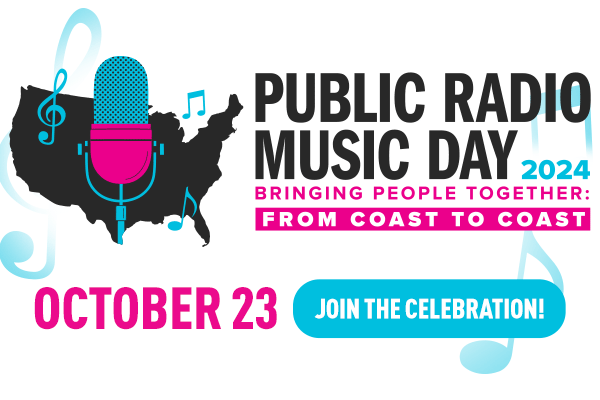
Public Radio Music Day was Wednesday, October 23rd, 2024. Doug welcomed Sarah Baker, Spike Sikes, Josh Windmiller & Rashida (Audio Angel), and Ellie James with Nick Carico. Hear the interviews below! Sarah Baker Spike Sikes (w/ more Sarah Baker) Josh Windmiller & Rashida (Audio Angel) Ellie James & Nick…
Enjoy this throwback episode of Brian’s World from October 2020 where Brian Elie interviews David Crosby. The COVID pandemic was gripping the world and Crosby was very candid about the effects of this on his life as a musician, among other topics. Give it a listen!
Mimi Pirard fronts 2 bands: SonoMusette, which recreates the sound of Paris Cafe Music, and Dgiin, a 6 piece rocking world music band that also features her brother, Gabe Pirard. Mimi talks about her music with Doug, and played some songs LIVE in the studio.
Doug talked with documentary filmmaker, Gary Hustwit about his new film, "Eno": a film that's different every time it's shown. Listen to Grandpa Doug as he tries to wrap his head around this new technology.
A new book, “How Women Made Music”, is inspired by NPR’s multi-platform series “Turning the Tables”. The book offers a window into the lives, struggles, and triumphs of the women who have defined musical eras, featuring excerpts from 50 years of NPR’s archival interviews, essays, and lists. NPR music journalist, Ann…
Amelia Day is a young singer-songwriter originally from Seattle (as is Brian). She took piano lessons as a child and picked up a guitar going into high school. She go the bug to start performing while attending Vanderbilt University in Nashville, where she spends much of her time. In the midst of a West coast tour,…
Alison Harris has a beautiful voice. You may remember her from the trio The Bootleg Honeys. She's also performed solo and with a band the Barn Owls. In advance of this weekend's Railroad Square Music Festival, she came in to share some new music. Have a listen!
Wreckless Strangers are a rockin' soulful band from the North Bay. They have just released a new EP "Blus Sky Fantasy." David Noble and Amber Morris stopped by Studio A to preview some material and got everyone in the building moving. Have a listen!
Margo Cilker is a very talented young singer/songwriter. She's spent some time here in Sonoma county honing her craft before releasing two wonderful albums on the Fluff and Gravy label. We're very proud of how far she's come since the open mic days around here. Listen to her chat and performance in Studio A.
Jake Stillman, Jon Bland and Caleb Poole from SRJC's student-run record label, Don't Flunk Me Records joined Doug on Midday Music. They talk about the label and how the music biz works. Have a listen!
Chuck Prophet is a Bay Area treasure. We're lucky he lives nearby giving us ample chances to see him and his band, the Mission Express. Chuck stopped by to chat with Brian and play the title track from his new album "Wake the Dead" due out October 25th.
Nina Gerber is not only an amazing musician, but a great friend to the radio station. Listen to her playing in Studio A and supporting our fall fundraiser.
Musician and Route 44 Studio owner Harry Gale joined Doug to talk about his latest project: Dust & the New Machine - Echoes of Chris Whitley. Harry visited on September 5th, during our Fall Fundraiser.
Zack Smith is fairly new to Sonoma County having moved here about four years ago. He is, however, well connected to the music scene. Zack founded the band Scandal in the 80's featuring singer Patty Smyth and songs written by the man himself. His new project is Wundercat who are starting to make the rounds at local…
David Luning is a familiar fixture in Studio A. He finally has a new album coming out. "Lessons" was recorded in a Petaluma barn -the "most magical place" according to David. We preview some tracks from the release and David plays a couple live as well.
Lila Forde, like Brian, is a native of Seattle. She's soon to release a new album "Vessels" which was entirely funded by family and fans. After moving to L.A. she was discovered by a scout from the TV show "The Voice" and finished in the finals joining John Legend for a song broadcast to millions. In the midst of a…
Kingsborough is one of the North Bay’s rockinest bands. They have put out several albums over the years and are a great live act. Billy Kingsborough and Alex Leach are close collaborators, coming up with memorable hooks and arrangements that stick with you like ear candy. They joined us in Studio A to premiere new…
Doug spoke with Reverend Wanika Stephens from the Saint John Coltrane African Orthodox Church about the Sonic Ascension Vespers at Grace Cathedral - Friday July 19, 2024
Musician Glenn Siegel and Ashleigh Worley from Luther Burbank Center for the Arts Joined Doug to talk about the LBC's Music Education Programs and Glenn's upcoming benefit to support them.
To get an idea of how long Chris Smither has been recording music, Brian was still in high school when Chris' first album was released. Coming out of the Boston folk scene with contemporaries like Bonnie Raitt (she's recorded several tunes by Smither), he is about to start a summer tour. His new release "All About the…
Hailing from Memphis, Amy Lavere and Will Sexton are no strangers to studio A. They always reach out when they're in our neck of the woods and they're always invited. Especially when they bring their instruments and sing and play for us. The married couple have several shows in our area this week. Hear a new song from…
Alice Wallace is one of the many Californians who have relocated to Tennessee. In advance of the release of her new album "Here I Am", Alice sat with Brian in studio A to talk about fireflies and to sing some tunes from her project. She's been a friend of the station for many years and we're glad to support her.
Stacy Antonel is a Nashville-based singer-songwriter who truly is an independent artist. Here 2022 release "Always the Outsider" got considerable airplay on KRCB. Her voice is amazing and her songwriting keeps getting better. She brought her guitarist Paul in for a session in studio A and to chat about life as a…
SRJC faculty members Jake Stillman and Mike Starkey joined students Max Bohlke-Slater and Jake Fuiten join Doug on Midday Music. Together, they talk about the music biz. (Photo: Courtesy of theoakleafnews.com)
Grammy winning Blues artist Cedric Burnside's music is full of the sound of Mississippi Hill Country. He is a talented and fascinating guy. Check out his interview with Doug!
Guitarist Asher Belsky chats with Doug on Midday Music. They talk about his upcoming performance at the Mill Valley Music Festival, and more. Have a listen!
Aoife O’Donovan has released her latest album “All My Friends." It’s the epitome of a concept album about the 100th anniversary of the passage of the 19th amendment giving women the vote. Brian and she talk about how some of the things the suffragettes experienced mirror modern times. They also remember her father, a…
Singer-songwriter and Mill Valley native, Amelia Einhorn (Meels) joined Doug in conversation from NYC. She is coming home for the Mill Valley Music Festival. Have a listen!
Rock and Roll Hall of Famer Rick Allen (Def Leppard) and his wife, Lauren Monroe, run a non-profit called Raven Drum Foundation. They joined Doug on Midday Music to discuss the healing power of music. Have a listen!
Guitarist Ethan Sherman is a Santa Rosa native now based in Los Angeles. He came to Rohnert Park to hand Doug a copy of his new CD, Passages. Have a listen!
"Queen of Time" the latest release from Nashville-based artist Lindsay Lou was created with the help of the psychedelic mists- journeying through self discovery while dealing with many life changes. The loss of her grandmother, the break-up of her marriage and the lockdown are all faced with grace and beauty. She…
Canadian singer-songwriter Royal Wood talked with Doug over the Zoom about his craft, and his upcoming performance at the Green Music Center on April 25th.
Sarah Jarosz has been making records since she was a teenager. Her seventh solo album "Polaroid Lovers" has been released and she is super excited about it. She chatted with Brian during a break from her heavy touring schedule.
Deborah Crooks and Kwame Copeland joined Doug on Midday Music. Together, they discuss and perform songs from Deborah's folk opera, Flight Lessons. Have a listen!
Jazz singer and songwriter Madeleine Peyroux joined Doug on Tuesday's Midday Music program to discuss her current tour, upcoming new album, and her wonderful career in music. Have a listen!
Comedian Matt Braunger joined Doug on Midday Music for a lively conversation about music, comedy and Matt's new TV special which is called, "Doug." Have a listen and a laugh!
The High Sonomen are Dave Hooper, Paul Riley, Dave Hamilton, and Ken Risling. They joined Doug in Studio A to discuss music, songwriting and to play some original songs. Have a listen!
The Founding members of 2 Bay Area bands join me today on Midday Music. Michael Tamony fronts the Legion of Decency, and Damon Wycoff leads Forever Goldrush . Both groups play original, singer-songwriter based Americana Music. Both bands perform Thursday 1/4/2024 at Sweetwater Music Hall in Mill Valley, and both bands…
Sonoma County Singer Songwriter Dave Monterey joined Doug on Midday Music to talk about and listen to Dave's new album, Moving Violation. Have a listen.
The Art of Eating: The Life of M.F.K. Fisher is a documentary film about the dramatic life and lasting impact of the California food writer. Director Greg Bezat and Producer Gary Meyer joined Doug on Midday Music to discuss. Have a listen!
We were thrilled to have a return visit from Duane Betts. A royal rock pedigree (dad Dickey Betts, and named for Duane Allman), the young Betts is making a splash with his newest release “Wild and Precious Life” featuring guest appearances by Nicki Bluhm, Derek Trucks and Marcus King. He performs a couple of songs…
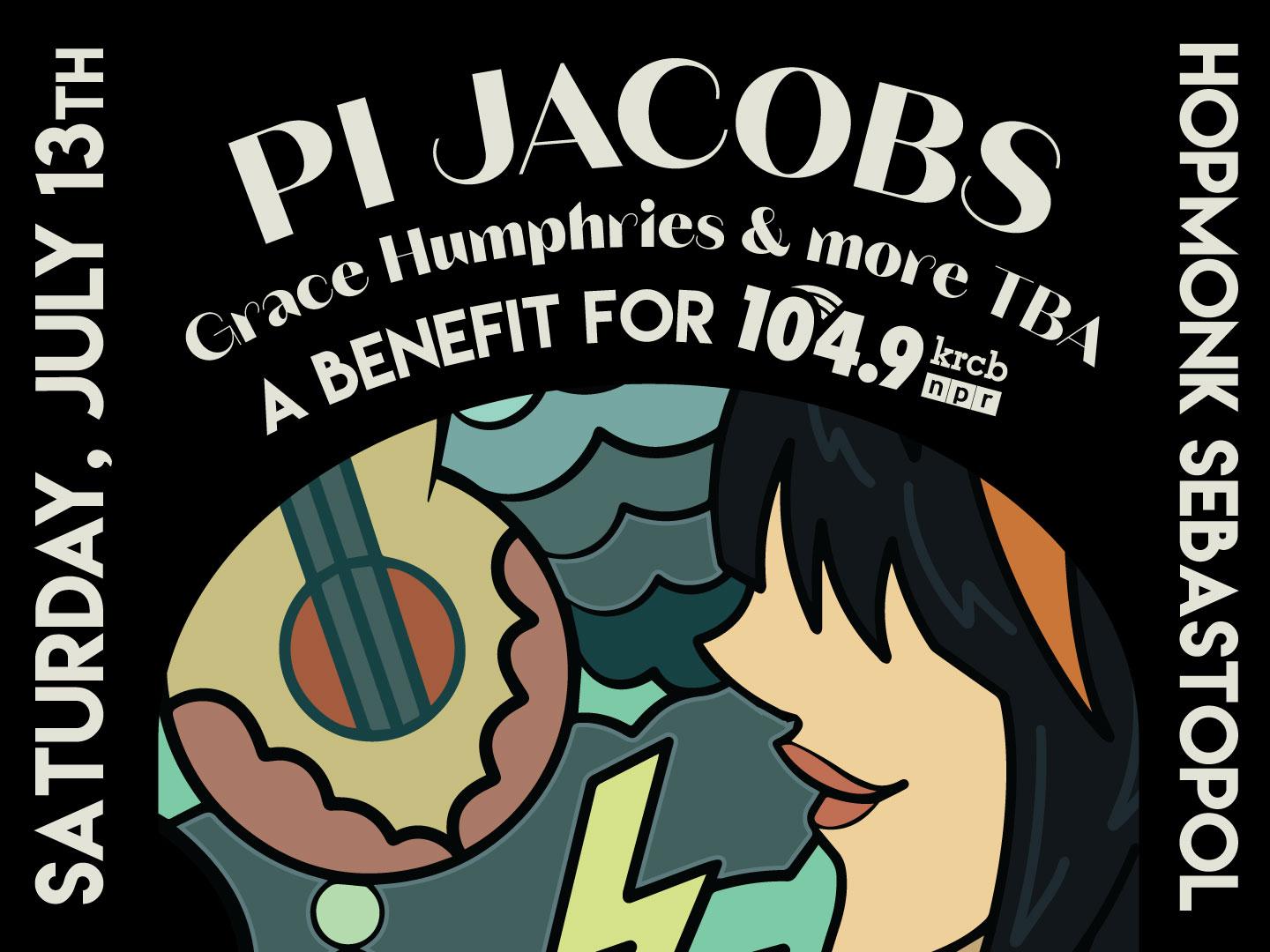
Pi Jacobs is a regular visitor to Studio A. The L.A. based singer-songwriter grew up in Sonoma County, and her frequent trips to see her family always include a couple of local gigs. She chats with Brian and performs new songs to be included on her next album due out next spring. Have a listen!
Gilbert O'Sullivan burst on the US airwaves in 1972 with "Alone Again, Naturally". This month, he performs in San Francisco for the first time! Doug spoke with Gilbert on the phone from England. Have a listen!
Born in England, raised in New York and a longtime resident of L.A., Lola Kirke, like so many Californians, has made the move to Nashville. Her acting career (Gone Girl, Mozart in the Jungle) drying up during the pandemic, she is now concentrating on her music. She was kind enough to pay a return visit to Studio A to…
Legendary Singer / Songwriter Joan Osborne checked in with Doug on Midday Music. They talked about her new album, "Nobody Owns You," and more! Have a listen!
The Highway Poets are a Sonoma County band that has been around for quite a while. Recently they have concentrated on solo projects, but they are coming together for a Halloween show this weekend. Travis and Sebastian stopped by Studio A for a chat with Brian and to play some tunes. Have a listen!
Golden Globe winning, and Academy Award nominated actor, John C. Reilly is coming to Sonoma County! He called Doug Jayne to get the "Midday Music Bump." Reilly performs Saturday and Sunday at the Sebastiani Theater in Sonoma.
The Wandering Hearts are a trio from London. Their beautiful harmonies filled the studio with warmth and vibrancy. They were opening some shows for country legend Marty Stuart and he was so impressed, he brought them to the states. Their first US show was at the Ryman in Nashville, the mother church of country music.…
Jobi Riccio has just released a whopper of a debut. “Whiplash” is getting great reviews, even Jason Isbell tweeted about it. Jobi and Brian met face to face last week in Nashville and coincided with this week's West Coast radio tour. She is charming and engaging and a hell of a songwriter and singer. Have a listen!
To celebrate Hispanic Heritage month Clementine Darling paid us a visit. Her father, of Mexican descent, would bring young Cassie to the homeland each summer. She gets teased by her family because of her Spanglish. She can be found playing throughout the Bay Area and has a new EP release “Bootstraps.” Have a Listen!
Stella Heath is the premiere jazz vocalist in the North Bay. Her various projects include Gypsy Django-style tunes, classic standards from the American songbook, and her wonderful Billie Holiday Project. She brings that to the 222 in Healdsburg this weekend. In this presentation, she not only performs some of Lady…
Anya Hinkle was kind enough to stop by studio A this morning. She shared some brand-new tunes and talked about her time as a grad student at UC Berkeley. Her new album drops next year.
Filmmaker Maureen Gosling chatted with Doug about her career, including the recently restored film J'ai ete Au Bal (I Went to the Dance). Have a listen!
The Pleasures if a duo of Australian artists that came together during the Covid lockdown. Catherine Britt and Lachlan Bryan have their own careers, but after the breakup of Catherine's marriage she reached out to Lachlan to help her put her feelings into songs. The result "The Beginning of the End" will soon be…
Solid Air stopped by to play a few tunes and have some conversation about stuff and things with Doug Jayne during Midday Music. Solid Air performs with the Temblors at the Occidental Center for the Arts on Saturday, August 26. Have a listen! Solid Air Fun Fact: Lead Singer Allegra Broughton is former program host of…
Joe Salinas of the Pomo Indian Dancers stopped by the studio during Midday Music with Doug Jayne. They talked about the upcoming Ocean Dance and more. Have a listen!
Nurse Blake spoke with Doug from Albuquerque, where he is on a Comedy tour that will bring him to the Luther Burbank Center for the Arts in Santa Rosa on August 16th. Have a listen!
Lindsay Musco joined Brian to talk about the upcoming Wine Country Distillery Festival. It’s happening August 12th at Luther Burbank Center. Lindsay is a brand-new mom so we’re hoping she gets some sleep soon. Have a listen!
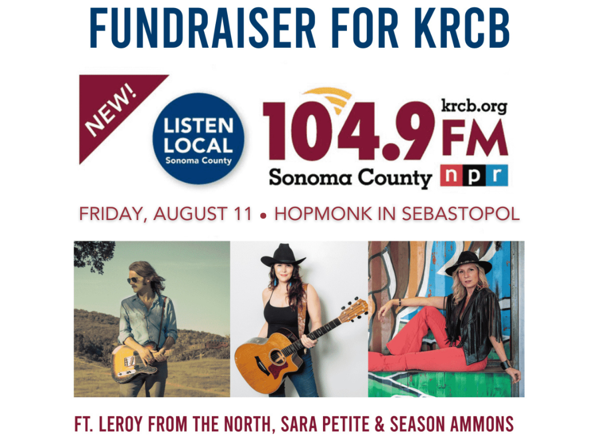
Sara Petite will be performing at our fundraising show at Hopmonk Sebastopol on Friday, August 11. Doug and Sara talk about that performance and more! Have a listen!
Director Starr Hergenrather, Music Director Miles McKenzie, and two young actors Caspian and Jiraiya Hergenrather all join Doug for Midday Music. They talk about the production A Musical Midsummer Night's Dream: Shakespeare Meets the Beatles at the Occidental Center of the arts. The show will be on Saturday, July…
Rachel Garlin is a Bay Area based singer-songwriter. Her new release “The Ballad of Madelyne & Therese” is a concept album telling the story of forbidden love in 1940’s New York. It’s a theatrical work that she will perform at the Lost Church in Santa Rosa this week. Listen to a conversation with Brian containing the…
The Wood Brothers have long been a favorite of KRCB listeners. They took local act Rainbow Sisters on the road and play here in the North Bay regularly. They are set to appear July 15th at Rodney Strong Vineyards to support their new release “Heart Is the Hero." Brian spent some time with Oliver Wood to talk shop and…
Most folks know Chris Shiflett as the lead guitarist of the huge rock band Foo Fighters. He also is a podcaster, interviewer, and has a great solo career dipping into country and Americana music. He’s bringing his own band to NorCal this August and has a new album coming out later this year. Brian spoke with Chris…
Cidny Bullens' long career in music as a songwriter informed much of his writing in his autobiography, TransElectric: My Life as a Cosmic Rockstar. He talks about his career and the book on Midday music. Have a listen!
Emma Hardyman is the vocalist and primary songwriter for the Utah- based band Little Moon. They have been chosen as the winner of NPR’s Tiny Desk Concert Contest. Emma is charming and a talented classically trained performer. The band appears at SF’s Brick & Mortar June 22, co-sponsored by KRCB
More than a year has passed since Russia Invaded Ukraine. Some who fled found a new home in Sonoma County. Among them, the Bezhenar family. Sisters Eleanor and Angelina, along with their mother Maria, stopped by to talk about a recent Stand Up for Ukraine benefit concert in Sebastopol. They even sang a few songs for…
Founding member from Joy of Cooking Terry Garthwaite joined Doug on Midday Music to reminisce and talk about the upcoming Stand with Ukraine benefit concert. Have a listen!
It would be an understatement to say the band Pablo Cruise have been around for a long time. Founding member Cory Lerios joins Brian to talk about the band's long career, and his more recent projects. Have a listen! (Photo: F. J. Jasinski, MYi2U™, CC BY-SA 3.0, via Wikimedia Commons)
Sataya Chavez stars in the one-person play “Where Did We Sit on the Bus?” now running at the Marin Theater Company. She joined Doug on Midday Music to talk musicals, acting, and looping. Hava a listen!
Nell Robinson and Jim Nunally Zoomed with Doug on Midday Music. They discussed Bluegrass guitar, the origins of Nell's name, Whippoorwill Arts, and their upcoming gig in Cloverdale. Have a listen!
Brett Cline, founder of The Lost Church, is transforming his mellow Santa Rosa listening room into a rollicking Boogie Dance Palace for one night with his band Edge City Fever. He joined Doug on Midday Music for some good conversation. Have a listen!
Avery Hellman, better known as Ismay, is an artist from the Bay Area that has known Brian since her first foray into the music business. Brian says, "It’s wonderful to see the development of a songwriter over time. Ismay has become more self-assured and her music reflects that." Ismay is opening for Misner & Smith at…
Clementine Darling has been in Studio A several times. She and Brian are friends, both being native Washingtonians and having birthdays the same week. Darling is releasing a new EP Friday. We had the radio premiere of “Bootstraps." Have a listen!
Dom Flemons has a new album, Travelling Wildfire. He's one of the founding members of the Carolina Chocolate Drops. Flemons talks about playing the banjo and fourteen other instruments. Have a listen!
Jim Welte is with the Mill Valley Chamber of Commerce. Everyone in town is gearing up for the 2nd Mill Valley Music Festival May 13th and 14th. Headliners include CAKE, Michael Franti and Spearhead, Valerie June, Andrian Belew and Jerry Harrison and many others. Jim spoke with Brian about the fest, the musical history…
Jackson Ahern is a poet, musician, and former bandmate of Doug Jayne. Ahern has attended and performed at several NationalCowboy PoetryGatherings. He shares stories and poetry on Midday Music. Have a listen!
Melissa Eleftherion is a Poet, Librarian, and current Poet Laureate of Ukiah! She joined Doug via Zoom for midday conversation and a bit of poetry reading. Have a listen!
Poet and worshipper of language Gwynn O'Gara joined Doug live in Studio A to talk poetry, read poems, and celebrate National Poetry Month. Have a listen!
Sonoma Native Ada Limón joined Doug on Midday Music. Ada is the 24th Poet Laureate of The United States. She has written six books of award-winning poetry. Ada discusses poetry, growing up in Sonoma, and reads some of her poems. Have a listen!
Kevin Russell, host of KRCB's Our Roots are Showing program, joined Doug on Thursday. Russell spoke passionately about his love of poetry, and how he uses poems in his day job as apsychotherapist. Have Have a listen!
Pierrette Montroy is a former program host at KRCB. She hosted the spoken word program Inkwell. Montroy stopped by Studio A to talk poetry and more with Doug. Have a listen!
Poet Cynthia Helen Beecher visits Midday Music with Doug Jayne. She reads poems and discusses living in Africa while working with The Peace Corps. Have a listen!
Drummer and founding member of the band Blood Sweat & Tears, Bobby Colomby joined Doug to discuss the film, What the Hell Happened to Blood Sweat and Tears? Have a listen!
Franco Tevini and Jeremy Lessnau talk about their LIVE comedy show called StandProv! It happens on the first Thursday of every month at The Lost Church in downtown Santa Rosa. Have a listen!
The Healdsburg Chorus can’t keep from singing, and their Director David Martin explains why. David is preparing the chorus for 2 performances, on Saturday, April 15, at 7:00 pm and Sunday, April 16, at 3:00 pm at The Raven Theater. Have a listen!
Jesse Rudoy's film, "Dusty and Stones," kicks off the Sebastopol Documentary Film Festival. Doug Jayne talks with Jesse about the most famous Country Music duo from Swaziland. Have a listen.
Singer-songwriter Meli Levi has been busy. She has just released a new EP, "Crowned." Levi is recording new songs and preparing for an upcoming show at The Lost Church. Meli chats with Doug Jayne on Midday Music. Have a listen.
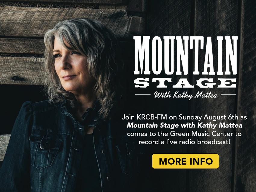
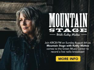
Kathy Mattea has returned to her West Virginia roots to take over hosting duties at Mountain Stage. KRCB has aired this program for many years, and it can be heard on Mondays at 10:00 pm. Photo credit: Reto Sterchi, via NPR
Sonoma County musician Hunter Ellis has a long history of playing in bands. His current band plays March 4th at The Lost Church in Santa Rosa. They will be featuring songs from Hunter's latest album, "Princess Daddy." He joined Doug on the phone for Midday Music. Have a listen.
Chris Pierce could be dubbed a modern troubadour. While considering himself a folksinger, he also writes and plays with blues and rock sensibilities. A native of Southern California, he has been able to have his music placed in television and movies. To top it all off he makes wine! He spoke with Brian about all this…
Filmmaker David Washburn and Film Producer Michele Luna talked to Doug about the tremendous new documentary that they made, Marguerite Wildenhain: The Art and Nature of Pond Farm. The world premiere is at the Rialto Cinemas in Sebastopol on Thursday, March 2, at 6:00pm. The documentary will also air on KRCB TV Monday,…
Brett Cline is the co-founder of The Lost Church, an intimate performance venue which has two locations (San Francisco & Santa Rosa). Brett spoke with Doug about the joy and challenges of the entertainment business in the age of Covid. Have a listen...
Photographer Ed Perlstein (pictured at a 1979 Grateful Dead show) joined Doug in Studio A on Thursday, February 16. Ed currently hosts two radio shows at KPCA-FM in Petaluma and is on a mission to digitize and preserve taped concert recordings (including some from the Studio KAFE) before they deteriorate. Have a…
Sam Misner and Megan Smith have been performing their original tunes and beautiful harmonies in the North Bay for many years. In fact, Sam grew up in Sonoma County. They recently returned to Studio A to sing and chat with Brian, their first visit since the pandemic. They are recording a new album and previewed a…
This is an approximately one-hour interview with David Crosby Brian Elie did at KRCB on October 12 2020 at 7:00 pm. The COVID pandemic was gripping the world and Crosby is very candid about the effects of this on his life as a musician, among other topics. Give it a listen!
Folksinger John McCutcheon comes to Northern California most every January. The renowned artist has almost 50 years of traveling under his belt, although he has cut back on his touring schedule since the pandemic. We’re glad his schedule allowed him time to visit Studio A!
Johnny Campbell writes songs, sings, and plays drums in The Pulsators. They are celebrating 30 years as one of Sonoma County’s best rockin' bands. Johnny joined Doug on Midday Music.
Ruthie Foster recently visited the KRCB studios with her spectacular smile and graced our airwaves with her phenomenal talent. She was on her way to a performance at the Freight & Salvage in Berkeley.
Singer-Songwriter Erin Sky visited KRCB on Thursday December 8. Erin talked about appearing at The Lost Church, and sang a couple original tunes in our Studio A.
Folk-singers Gary Weiner and Larry Heiman joined Doug in Studio A to discuss the early days of Sonoma County's music scene. They performed a couple songs LIVE, and even broke out an old KVRE vinyl record to play. "Gary Weiner and Larry Heiman – 50 years of Friends and Folk." Together, they celebrate their decades-long…
Angela Strehli hand-delivered her tremendous new album, Ace of Blues, to us today. Nice chat with Doug from Studio A. (Photo by Ron Baker CC BY-SA 2.0)
Andrea Von Kampen is a songwriter from Nebraska. She sings beautifully and is starring in her first film role. Filmed in Sicily, the movie “A Chance Encounter” is out tomorrow. She wrote the music for the film too. Listen to her chat with @brianontheradio.
Documentary filmmaker Kathlyn Horan joined Doug on Midday Music.They discussed her new project, “The Return of Tanya Tucker - featuring Brandi Carlile."
Nikki Lane is a firecracker. She says what she means and has zero f*%#s to give. Brian shares his story of their reunion and Nikki talks about working with Josh Homme of Queens of the Stone Age on the new release “Denim & Diamonds."
Loudon Wainwright III has been part of the soundtrack of our lives for fifty years. From “Dead Skunk” to his latest “Lifetime Achievement," his songs make us smile and think. He chats with Brian about his career in music, acting and the progeny he has brought to us. (Photo: Shervin Lainez)
Zoe Fitzgerald Carter is a talented singer-songwriter who is performing Saturday, October 1, at The Lost Church in Santa Rosa.Carter spoke with Doug Jayne on Midday Music.
Julian Lage is an internationally recognized jazz guitarist. Born In Santa Rosa, Julian first became known through a short documentary when he was just 8 years old. He performed at the Grammy awards when he was 12. He has taught at Stanford and the New England Conservatory of Music, and has blossomed as a performer.…
Amy Ray was at the airport getting ready to fly to Sonoma County for tonight’s Indigo Girls show at the Green Music Center. She spoke with Brian about the queer country movement, upcoming IG projects and more.
Will Hoge is a rare breed in Nashville, a native. His new release “Wings on my Shoes” is full of stories about troubadours, Southern places, and deities. Will filled Brian in on what to expect weather-wise in Tennessee next week.
Bryce Dow-Williamson gets on the horn with Doug Jayne to talk about upcoming shows at the Lost Church, including StandProv! hosted by Jeremy Lessnau & Franco Tevini. That show is Saturday, September 3! Jeremy and Franco joined Michael O'Brien live in the studio on Sunday (pictured, right). Get the full schedule…
Although based in L.A., Pi Jacobs grew up on a commune in Sonoma County. She is always a pleasure to host when she comes home for a show, or just to see her mom.
Some wonderful local musicians, Alison Harris and Lenkadu, are working to showcase women with their ‘In the Limelight’ series beginning Friday 9/2 in Petaluma.
Kelsey Waldon is a student of classic country music. Her records pay homage to the great artists of the past, with a nod toward the future. Her new release “No Regular Dog," produced by Shooter Jennings, features her plaintive Kentucky vocals and brilliant songwriting.
Longtime San Francisco resident Chuck Prophet came up to Studio A to chat with Brian and sing some songs. You can see him and his band each Sunday this August at the Twin Oaks Roadhouse in Penngrove.
Amanda Shires has always enjoyed her visits to Studio A. We feed her and her band and give them rides to save on Uber bills. She has just released “Take It Like a Man," an album that reflects the trials of keeping love alive. Brian spoke with her about the new work and her ongoing support of women's health issues.…
Arlo McKinley was the last act John Prine signed to his Oh Boy record label. Just as Arlo’s debut was released, Covid hit. Tour plans ground to a halt and Prine was taken from us. McKinley's follow-up, “The Mess We’re In,” is out now and reflects the pain and boredom of the last two years.
Jason Eckl, guitarist and founding member of the band Dirty Cello has a new project: Conductor of Renegade Orchestra. Jason spoke with Doug Jayne about this unique, and exciting ensemble. (Photo: Niall David)
Michaela Anne has been a good friend of KRCB for many years. She always takes the steps to join us in studio A when she tours through California. Her new release “Oh To Be That Free” was recorded during the pandemic at home in Nashville by her husband Aaron.
Doug Jayne spoke with Carmen Snyder, Executive Director of Sonoma County Farm Trails. Carmen also books the music for the Gravenstein Apple Fair, which returns this year after a 2-year hiatus.
Ukulele master Jake Shimabukuro spoke with Brian about his upcoming show @ Charles Krug winery, home schooling his kids during the pandemic, and Hawaiian culture. His latest release “Jake & Friends” features duets with Willie Nelson, Kenny Loggins and more.
Brian Griffith and Nellie McKay have been friends for almost 20 years. Although her schedule didn’t allow an in person visit this time, she has performed in Studio A many times. She is doing a two night stand at SF Jazz this week.
BJ Barham, the front man and songwriter for the Raleigh, NC band American Aquarium joined Brian this morning to talk about the new release “Chicamacomino.” Written during the winter of ’21 in the Outer Banks, the pandemic and the losses all of us faced play throughout the record. www.americanaquarium.com
Santa Rosa Singer Songwriter Stevie Cornell has been a member of San Francisco bands, The Movie Stars and Red Meat. Stevie and his bass player, Alan Weiss, visited Doug Jayne to talk about their upcoming gig at The Lost Church, and to play a few songs in our studio. Stephen Lawrence Stevie Cornell Duo w/ Jeff Troiano…
We are big fans of Rickie Lee Jones. A few weekS BACK, Doug spoke with her about her new memoir “Last Chance Texaco.” This morning Brian chatted with the New Orleans-based artist about her career and upcoming concerts in the Napa Valley. https://www.facebook.com/RickieLeeJones
(Photo by KRCB)Musician Frankie Boots stopped by the studio to talk about his new album, Free Range Songs, Americana and Roots music, and his upcoming move to Nashville. Hear music, conversation, and fun!
Brennen Leigh has collaborated with a lot of artists who have become friends, many of them featured on KRCB. Noel McKay, Melissa Carper and most recently Ray Benson have all chatted with Brian. Brennen has teamed up with Ray & Asleep at the Wheel for “Obsessed with the West”, a delightful collection of Western Swing…
Crain McArthur with Casual Heart Productions chats with Brian about a brand new outdoor performance venue in Mill Valley. The Junction features seating for 500. Learn more about it! https://www.thejunc.com/
Ismay joined Brian for Morning Music. She performs at the SOMO Redwood Grove along with The Coffis Brothers tonight. (Photo by Giant Eye Photography) https://www.facebook.com/ismaymusic
Carmen Snyder, Executive Director of Sonoma County Farm Trails, chats with Brian Griffith about the upcoming Gravenstein Apple Fair. It's coming to Sebastopol's Ragle Ranch Park, August 13th & 14th.
The Coffis Brothers stop by for Midday Music on their way to SOMO Redwood Grove for a performance. Music and conversation follows. https://www.facebook.com/CoffisBrothers
Nicki Bluhm has a new collection of tunes. “Avondale Drive” is the second album she’s put out since her move from the Bay Area to Nashville. She spent Wednesday morning talking with Brian about it’s development and how it is different from her past work. https://www.facebook.com/nickibluhmandthegramblers…
Stevie Coyle checked in with Doug about growing up in Southern California, his first guitar, his band The Waybacks, and his duo, The Quitters, who will perform at The Occidental Center For The Arts on Father's Day! Hear music and conversation... https://www.facebook.com/StevieCoyleMusic http://www.steviecoyle.com/
Mary Moore performed at Sunday’s Railroad Square Music Fest. An astute listener introduced her to Brian, who promptly invited her to Studio A. Music and conversation ensued.
Jacob Phillip Benning performs at The Lost Church in Santa Rosa Saturday, June 11, at 8pm. Hear music and conversation with Doug Jayne. https://www.jacobphilipbenning.com/
The Sam Chase dropped by Studio A to personally bring a copy of the new release “You Call This an Album” written by him and featuring his crackerjack band the Untraditionals. Joining Sam and Brian was Chandra Johnson, longtime fiddling bandmate. Check out the new tracks. http://www.thesamchase.com/
Local rockers Kingsborough stopped by Studio A to play some tunes and talk about their upcoming gigs at the Railroad Square Music Festival, and the Blue Note Café. https://www.facebook.com/KINGSBOROUGHBAND www.kingsboroughmusic.com https://www.railroadsquaremusicfestival.com/
Free Range folk from Sonoma County, the Musers are multi-instrumentalists and award winning song-writers. They bring their homegrown music with verve and heart to the Lost Church in Santa Rosa on June 11th. Hear their visit to KRCB with Doug Jayne during Midday Music. https://www.facebook.com/themusersband/…
Local musician Kayatta brings her unique sound to The Railroad Square Music Festival on Sunday June 12. She performs at the Metro Chamber Stage at 4:15pm. Kayatta spoke with Doug Jayne about her music and the challenge of being a female artist. https://poemsandpaper.com/home https://www.facebook.com/kayattamusic…
Margo Cilker is excited to be back on tour and excited to be back at KRCB. She chatted with Brian during Morning Music. https://www.facebook.com/margocilker https://www.margocilkermusic.com/
Ken Tesler, Managing Director of Blue Note Napa, joined Brian Griffith on the phone to talk about their busy concert season now underway. https://www.bluenotenapa.com/ https://www.facebook.com/bluenotenapa
East Dallas Singer-Songwriter Joshua Ray Walker is on tour with his band. He stopped by KRCB to talk with Doug Jayne and play some songs. Joshua Ray is a rising star in Americana Music. http://www.joshuaraywalker.com/ https://www.facebook.com/joshuaraywalkermusic (Photo: Courtesy of the artist/Facebook)
Eilen Jewell joined Brian for Morning Music to promote her upcoming show at the Hopmonk in Sebastopol on Thursday, June 2nd. https://www.eilenjewell.com/ https://www.facebook.com/eilenjewellfanpage (Photo: Courtesy of the artist/NPR)
David Luning stops by to promote the FIRST David Luning Band Sonoma County show since December! This Sunday, May 25 at the SOMO Redwood Grove, he performs with John Courage! And the best part - an official handmade fedora will be auctioned off only at this show! For tickets: https://biglink.to/SecondOctave…
Aaron Raitiere is an up and coming Americana musician out of Kentucky. With a little help from good friends Miranda Lambert and Anderson East, his debut release is out. It's called Single Wide Dreamer. Raitiere talks about that and more. https://www.facebook.com/aaronraitiere (Photo credit: Alysse Gafkjen)
Betty and Ken Rodgers’ poignant new documentary, I Married the War, focuses on eleven military wives who have had to deal with their husbands’ emotional and physical wounds of war. Betty and Ken Rodgers co-wrote, produced, and directed the film, which includes testimony from three Vietnam War veterans’ wives: Francine…
Danny & Essence perform as Johnny & June Forever - A Tribute to Johnny Cash and June Carter. They stopped by to promote their upcoming show on Friday May 20th in the Abbey at HopMonk Tavern Sebastopol. Doors open at 7pm. Show at 8pm. It's their first public performance in over two years!
In the category of Societal Concerns - News or Long Form Content, NorCal Public Media and Blue Coast Films won an Emmy for the hard-hitting documentary 3 Seconds in October: The Shooting of Andy Lopez. We revisit an interview with Filmmaker Ron Rogers, who joined Doug Jayne on the phone in May 2022 to talk about the…
Aaron Lee Tasjan stopped by to hang out with Brian on his way home to Nashville after a couple of shows in California. He talked about his Grammy award nomination, new songs, and Bobby Bare, Jr. It’s always a pleasure to see ALT. Hear the conversation below.
Hanna Haas stopped by Studio A to share music from her new release “To Her, The Sea." Hanna's first radio interview was with Brian several years ago, he loved seeing her growth as an artist.
Smokehouse Gamblers perform at the Mystic Theater in Petaluma. Jim Jacobs stopped by for Morning Music to promote the show, the Petaluma Music Festival, and more! Hear the conversation below.
Dirty Cello stopped by the KRCB studios for Midday Music to promote their upcoming concert at SOMO Concerts in Rohnert Park on May 14! And they played a couple of songs live! Tickets and more available at dirtycello.com Hear the visit below.
Singer-songwriter Josh Rouse joined Brian in-studio while on a tour of the West coast. They spoke about his living in both Spain and Nashville. Josh has a new album coming out in July recorded entirely in Valencia and shared some of it with us. Hear the conversation below. (Photo: Brian Blauser/courtesy NPR)
Rickie Lee Jones burst on the scene in 1979 with her smash debut album Rickie Lee Jones, a hit single with Chuck E's in Love, and an appearance on Saturday Night Live. Rickie Lee spoke with Doug Jayne recently and talked about music, her memoir, Last Chance Texaco, Rice-A-Roni, and her upcoming shows at the Blue Note…
Ian Noe called Brian to chat about his new release “River Fools & Mountain Saints”. The Kentucky singer-songwriter talks about his inspirations, from the characters he witnesses in Appalachia to fingerpicking lessons with John Prine. Check out the conversation below. (Photo credit: Melissa Stilwell Photography)
Taylor Rae is a promising young artist originally from the Santa Cruz mountains who now calls Austin home. Her new release “Mad Twenties” is a fully realized collection of original tunes. Hints of jazz, country and Americana flow through the album, making it impossible to pidgeon-hole. Rae joined Brian to talk about…
Recently, Steve Mencher joined Doug Jayne on Midday Music. Steve is KRCB’s former news director, and current producer of our award-winning environmental podcast, Living Downstream. Steve recently attended SXSW and shared the experience. Great music, wonderful films, and insider tips on attending the festival. Hear his…
The Real Sarahs perform at the Hopmonk in Sebastopol this Saturday. But first, they stopped by the KRCB 104.9 studios to chat with Brian for Morning Music. Their minimalist approach to instrumentation really highlights their skillful harmonies and heartfelt songwriting. Hear for yourself below.…
The Wreckless Strangers squeezed into Studio A this morning to share music from their new release “When the Sun and a Blue Star Collide”. A diverse collection of well-known musicians from the North Bay including Austin De Lone, Mick Hellman, David Noble, Josh Zucker, Rob Anderson and powerhouse vocalist Amber Morris…
Megan McLaughlin and Tom Kuhn of the Musers stopped by during Doug Jayne's Midday Music show and played a few live tunes. The also talked about what's coming up for the band and their show at the Hopmonk in Sebastopol on Saturday, April 2nd. Hear the full conversation below. https://www.themusersband.com/…
Boston-based Twisted Pine perform at The Lost Church Wednesday night (3/30) at 7:30pm. The band stopped by to chat with KRCB Music Director Brian Griffith. Hear the conversation below! https://www.twistedpineband.com/home https://www.facebook.com/twistedpinemusic
A four-time Grammy Award-winner and ten-time nominee, Sarah Jarosz is touring her Grammy-nominated Blue Heron Suite and her 2020 Grammy-winning World on the Ground. She'll be playing the Mystic Theater in Petaluma on April 2nd. She joined Brian for Morning Music on Wednesday. Hear the conversation below.…
Alison Harris joined Brian to promote her upcoming appearance at Hopmonk/Sebastopol supporting Della Mae on Tuesday, March 29th. Alison is well known to NorBay music lovers as a former member of the Bootleg Honeys as well as for her solo work. Alison also teaches with voice, piano, and performance classes…
June Millington has done a lot. Besides fronting the band, Fanny, she is a star in Women's Music, created the Institute for the Musical Arts (IMA), wrote a memoir, and had a documentary film made about her. June spoke with Doug Jayne on Midday Music. Hear the conversation here.…
Documentary filmmaker Bobbi Jo Hart celebrates the screening of her film, "Fanny: The Right to Rock", by visiting Doug Jayne. Bobbi Jo talks about the process, her 25-year career, and getting to know Fanny, the first all-girl rock band to be signed to a major label over 50 years ago. Hear the conversation here.…
Doug Jayne interviewed film director Ted Roach during Midday Music. His film, "Leftover Feelings: A Studio B Revival," closes the Sebastopol Documentary Film Festival on March 27. Hear the conversation here! For more information visit https://sebastopolfilmfestival.org/
Liam James Doyle/NPRUkrainian President Volodymyr Zelenskyy will deliver a virtual address to Congress Wednesday morning. His remarks come as the Russian invasion of Ukraine enters its third week.
Only a handful of people were backstage with the Rolling Stones at Altamont or watched The Beatles' very last live performance together on the roof of Apple Records. Ethan Russell is one of them. Ethan talked to Doug Jayne on Midday Music. His one man show, "The Best Seat in the House," comes to Saratoga on March 19.…
Blues Americana singer/songwriter Katie Knipp is blessed with a powerful voice and knows how to tell stories using a piano, guitar, dobro, and harmonica. She's working on a new live album which is due out this month. She'll be appearing at Sweetwater Music Hall in Mill Valley on March 17. She spent some time chatting…
New York singer/songwriter and friend of the station, Lucy Kaplansky talked with KRCB Music Director Brian Griffith about her upcoming show at the Hopmonk Tavern in Novato on March 11, and more! Check it out here! Her new album, Everyday Street, is her first solo album since 2012. Available as a download or at her…
Kentucky singer/songwriter Rhyan Sinclair's new album, Letters to Aliens, is out now! She joined KRCB Music Director Brian Griffith to talk about her latest release, her musical family, and how she sent letters to aliens. Check it out here! https://www.rhyansinclair.com/
Erica Ambrin is a singer/songwriter living in Sonoma County who captivates the audience with her soulful voice and dynamic style. She has shared the stage with Nappy Roots, The Wailers, Martin Luther, Anuhea and was a contestant on American Idol. She chatted with KRCB Music Director Brian Griffith about why her music…
Doug Jayne has been a fan of Freedy Johnston for a long time. Johnston's breakthrough album on Bar None Records was 1992's Can You Fly. Johnston then signed to Elektra Records and in 1994 worked with producer Butch Vig on his biggest record, This Perfect World. This album featured the radio hit “Bad Reputation,” which…
Rebecca Roudman fronts the popular NorCal group, Dirty Cello. This week the band releases a new CD, "Dirty Cello Smokes the 60s." It's a revisit of classic rock like you've never heard! To celebrate, Dirty Cello performs two nights at Hopmonk in Sebastopol: Friday, March 11, and Saturday, March 12. Rebecca joined me…
Bluesy, jazzy, souly, funky, rocky Taylor Rae has two Sonoma County tour dates this weekend and chats with Brian a bit on Friday's Mornign Music show! She kicks off the Appalachian leg of her tour next week! Hear the conversation here. https://www.taylorraemusic.com/tour
Sarah Borges is a Boston native and her new album, “Together Alone,” comes out Friday, February 18th. Hear Sarah's conversation with KRCB Morning Music host Brian Griffith.
Hiss Golden Messenger’s lead is MC Taylor. The band is currently on tour to support the 2021 release “Quietly Blowing It.” Hear MC's conversation with KRCB Morning Music host Brian Griffith.
Sam Chase of The Sam Chase & the Untraditional joins KRCB Music Director Brian Griffith to talk about his new release due later this spring. It's tentativelycalled “You Call This an Album?” He also talks about his upcoming show at the Hopmonk, Sebastopol, and John Prine. Have a listen!
Credit: Michael O'Brien/KRCBSo much fun having the female folk harmony group Bad Luck Magpies visit Studio A to play and chat about their upcoming show at the Lost Church. The three singers from a variety of different bands have created an exciting new group that blends their beautiful voices and lush instruments.…
Brian had a nice chat with Rock and Roll Hall of Famer, and founder of the Lovin’ Spoonful, John Sebastian. They spoke of the new release “Exploring the Lovin’ Spoonful Songbook” featuring Arlen Roth and special guests, John’s accidental Woodstock performance and how not to make Bonnie Raitt angry. (Photo: Courtesy of…
Brian had a lovely chat with his friend Amanda Shires during Morning Music on Wednesday, December 8, 2021. They talked about her new holiday album “For Christmas," a recent health scare that sent her to the hospital, and her fight for women’s reproductive rights. Learn more about Amanda Shires. Hear Morning Music with…
Bruce Cockburn is one of the most beloved and celebrated singer-songwriters in the world. Just prior to starting a tour to promote his new album, Greatest Hits 1970-2020, Bruce took the time to speak with Doug Jayne about Canada, The Beatles, and the first time he heard himself on the radio! The interview aired…
December 1 was an exciting day at KRCB 104.9! Doug Jayne came to work early to do a phone interview with Bruce Cockburn. Jayne told Cockburn he was particularly excited because two of his heroes, the Smothers Brothers, were in the next studio recording an interview with Marc Maron for his "WTF" podcast. "When my show…
Sarah Baker spoke with Doug Jayne during Midday Music on November 2, 2021. (Photo courtesy of Sarah Baker)The conversation is just beginning. I Married the War, Wives of Combat Veterans Tell Their Stories, premiers virtually November 6th at 7:00 pm Eastern The groundbreaking film tells the stories that expose the…
 Live Radio


 NorCal Public Media’s Original series “Prepare Yourself!” takes a unique approach to disaster preparation, with clever satire, entertaining skits, and original music. Our hosts guide you through memorable moments that have fun, yet relay important information about home emergency kits, go-bag readiness, property protection, and how neighbors and communities can help each other during emergencies and evacuations.