Live Radio
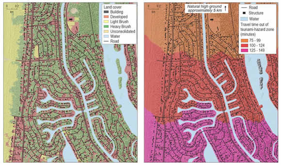
Recently, it released a new tool to pinpoint areas of danger to help residents plan ahead.
{audio}http://cpa.ds.npr.org/krcb/audio/2014/11/11-12-14.mp3{/audio}
The tool is called Pedestrian Evacuation Analyst, it works as an ArcGIS extension and can be used to estimate the time it would take someone to leave a hazardous area on foot in the event of a tsunami (or even a flash flood or volcanic lahar). It factors elevation changes and land cover types into its estimates. This should help emergency planners evaluate the need and potential benefits of vertical evacuation structures and community training.